
Taranaki Maunga
See a recent, timestamped photo of Taranaki Maunga from our scene photo system and use it to create an AI travel portrait or landscape.
Taranaki, North Island, New Zealand
 Selected as reference
Make a Taranaki travel photo
Photo Type
Use the landscape, clouds and light in this photo as references for your travel photo.
The mountain from New Plymouth
Taranaki Maunga is a 2,518-metre volcanic peak in Te Papa-Kura-o-Taranaki on the west side of New Zealand’s North Island. From New Plymouth, the cone rises behind a low, tree-lined foreground. On a clear frame you can pick out the summit and snowline. When clouds are low, look for the lower slopes and layers of cloud instead.
Explore Te Papa-Kura-o-TaranakiHow to make your travel photo
Check the real scene
Check the capture time. Keep the real scene reference for this frame, or switch it off to generate from the current local conditions.
Choose who’s in the photo
Choose Travel Portrait and upload clear photos of the people you want to include, or choose Scenery Only to focus on the mountain.
Create and compare
Choose an aspect ratio and generate. Then open the original from the photo credit to compare the setting and the AI result.
Two ways to frame Taranaki Maunga
Travel Portrait
Try a vertical 3:4 frame to leave room for both the person and the summit. Choose a reference photo with clear facial features.
Scenery Only
Use a wide 16:9 frame to keep the cone and foreground in view. A band of cloud across the slopes can give the landscape depth.
What a real camera photo adds
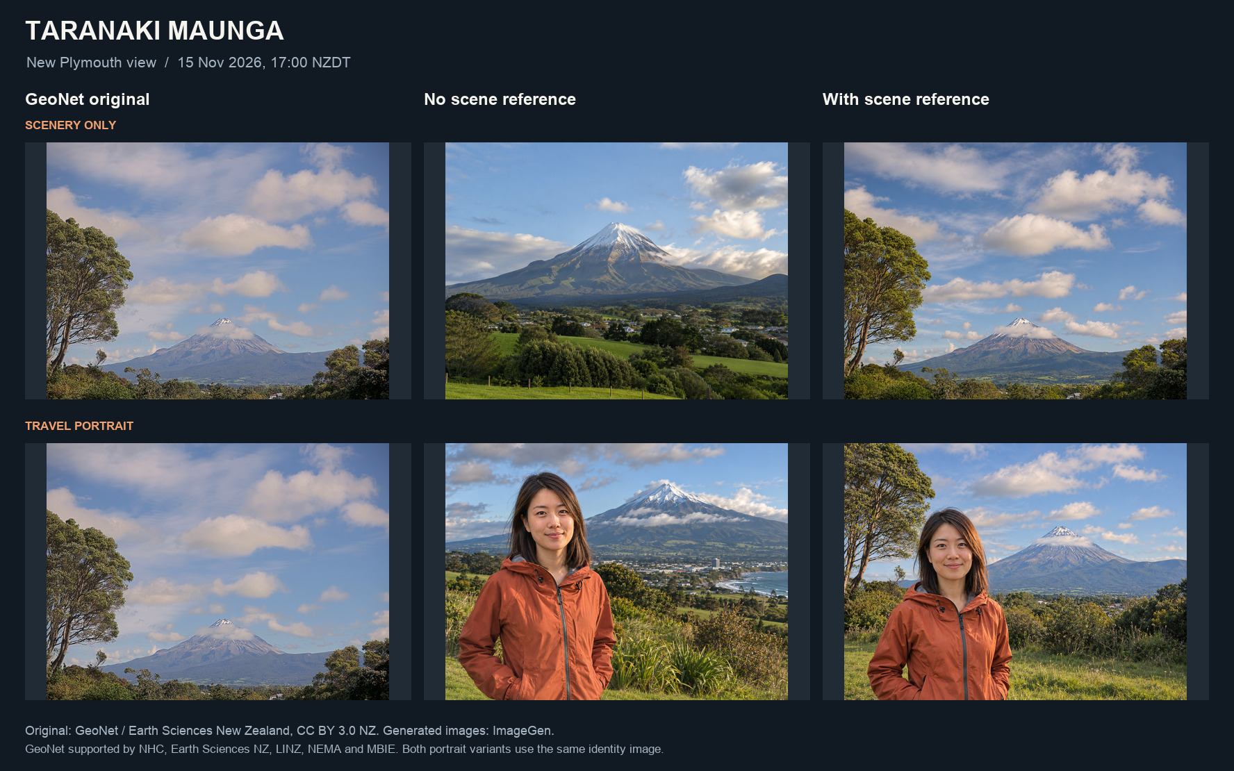
In this ImageGen comparison, the GeoNet reference helped preserve the mountain profile, cloud band, and foreground trees. The original was taken on 15 November 2026 at 5:00 pm in New Zealand. These examples show what changed with one archive frame.

Taranaki Maunga FAQ
How recent is the photo on Teleport Me?
Our scene photo system checks trusted sources every 15 minutes for the latest available high-resolution photos. High-resolution files can arrive later than camera snapshots. The caption shows the original capture time in New Zealand.
What if clouds hide the summit?
If clouds cover the summit, check the official camera again later and compare the timestamps. If you generate from the photo while it is cloudy, those clouds are part of the scene the AI uses as its reference.
Where is the official Taranaki Maunga webcam?
GeoNet publishes timestamped still photos of Taranaki Maunga (Mount Taranaki) from its volcano monitoring camera in New Plymouth, New Zealand. Check the latest images on the official camera page to see whether clouds are hiding the summit.
GeoNet / Earth Sciences New Zealand · CC BY 3.0 NZ
GeoNet · NHC, Earth Sciences NZ, LINZ, NEMA, MBIE